EcoVision Lab
EcoVision Lab – Machine learning for environmental sciences and geosciences
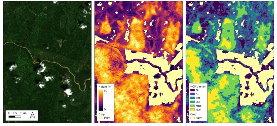
The EcoVision Lab does research at the frontier of machine learning, computer vision, and remote sensing to solve scientific questions in the environmental sciences and geosciences. Its objective is to invent original, data-driven methods that analyze environmental data at very large scale automatically. We innovate on a very technical level and closely collaborate with our colleagues from, for example, ecology to jointly find new ways to protect our environment at global scale. Scientific projects include global mapping of vegetation parameters like canopy top height and carbon stocks at very high spatial and temporal resolution, monitoring of agricultural land, water-level prediction under flooding scenarios, or establishing a rapid-alert system that detects deforestation. On the technical side, we investigate exciting topics like uncertainty quantification in deep learning, explainable AI, graph neural networks, or time-series analysis with neural ordinary differential equations. We believe that interdisciplinary research is key to scientific breakthroughs and always aim at putting our research into practice by collaborating with NGOs, company's or public administration.
Contacts
|
|
Prof. Dr. Jan Dirk Wegner University of Zurich Winterthurerstrasse 190 Y11 F 34 |