Navigation auf uzh.ch
Navigation auf uzh.ch
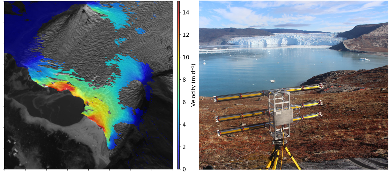
The Glaciology and Geomorphodynamics Group uses and develops remote sensing methods for observing and quantifying the dynamics of glaciers, ice sheets and high mountain permafrost to better understand processes and links to climate. We use data from a large range of platforms such as satellites, UAVs (drones) and terrestrial interferometry and from a variety of sensors (optical, radar, thermal, altimetry). We investigate processes in high mountains and polar regions at a wide range of spatial and temporal resolutions, from the cm to the global scale and from minutes to multiple decades. Some examples are trends in glacier extent, surface elevation and debris cover, variability of glacier flow velocities, quantification of iceberg calving and changes in glacier forefields and rock glacier dynamics. Our process studies combine remotely sensed data with in-situ field observations and numerical modelling.
We contribute to the European Space Agencies (ESA) - CCI program (https://climate.esa.int/en/) and to global initiatives such as GLIMS (https://www.glims.org). We have also established collaborations with industrial partners such as ENVEO (https://www.enveo.at), GAMMA Remote Sensing (https://www.gamma-rs.ch) or EODC (https://eodc.eu).
|
|
Prof. Dr. Andreas Vieli Head of Glaciology and Geomorphodynamics Group Tel: +41 44 635 5120 |