Navigation auf uzh.ch
Navigation auf uzh.ch
This month we have interviewed Claudia Röösli, group leader at the Remote Sensing Laboratories and head of NPOC for satellite data. At the UZH Space Hub, she is the expert for Earth Observations and Remote Sensing. In this interview, she told us more about her research on biodiversity.
What is the main area of your research?
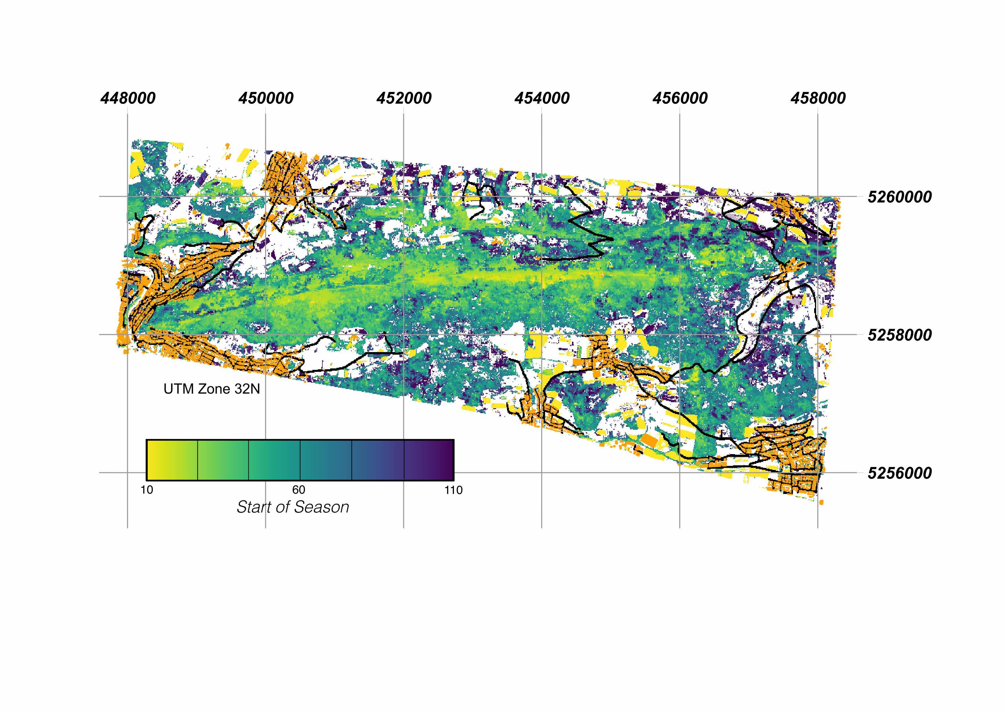
My main area of research is using remote sensing for biodiversity monitoring. I use satellite images time series for assessing different aspects of the biodiversity where I currently focus on the yearly cycle of vegetation activity resulting in the so-called Land Surface Phenology (LSP). LSP gives then measures such as the start of the season (e.g., related to leave unfolding) or senescence (e.g., colouring of the leaves before autumn) phase. The observation can then be extended and combined with other variables coming from remote sensing or in-situ observations that are part of the so-called Essential Biodiversity Variable (EBV) framework.
What do you like most about your job?
I like most the possibility to work in very different fields of applications and together with different players. One of my core tasks is to lower the hurdle for everyone to use satellite data, be it for biodiversity assessment or for everyone's life or business. In addition, with using satellite data, you always have nice pictures to look at from around the globe.
What is your connection to the Space sector?
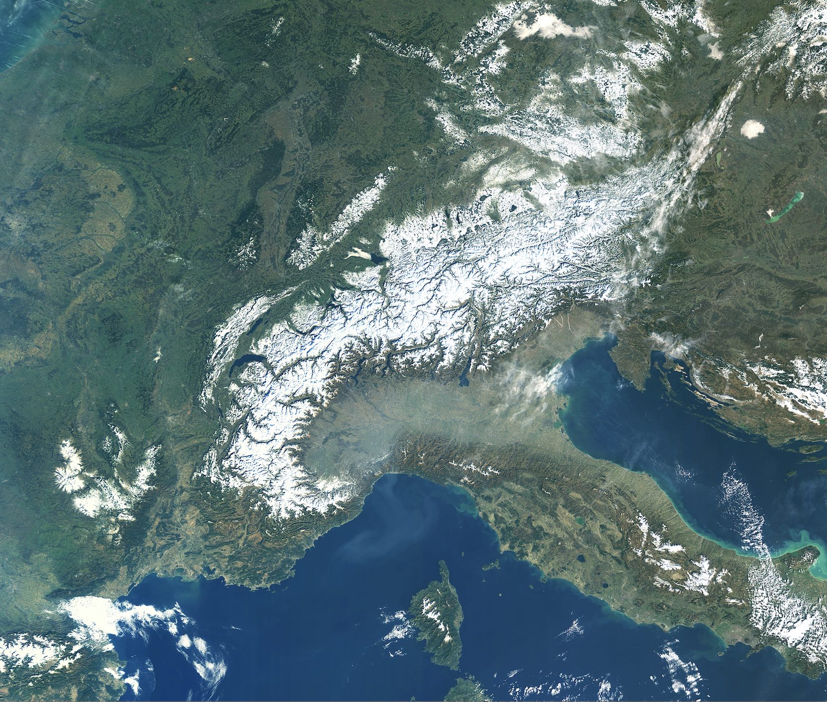
My work is mainly based on satellite images coming from the Copernicus Sentinel satellites and is supported by the European Space Agency ESA. I'm already working since 2015 mainly in the space sector, currently also active in the operational team of the UZH Space Hub. In addition, I'm the head of the National Point of Contact for satellite data funded by the Swiss government to foster the use of satellite data. Everyone who would like to start using satellite data or need some scientific input to use the data can contact us and get some advice. Next to biodiversity, I also work in the domain of innovation in the space domain, consultation and outreach for general use of satellite data.
What do you like about Space?
For me space is very efficient in observing the Earth. Few satellites orbiting around the globe allow us to get a high-resolution status of the Earth almost every time. I'm also fascinated by the technology needed to be able to have the satellite in its right orbit and with a working instrument looking at small details on the Earth surface.
What would be the greatest achievement in the Space Sector?
For me, a great achievement would be to tap the full potential of the data coming from Copernicus Sentinel satellites to have a decent base for monitoring the Earth's health status or more applications for facilitating everyone's daily life.
You are part of the UZH Space Hub: What do you think this will mean for you and your research?
Within the UZH Space Hub I get new inputs and ideas regarding needs and applications. In addition, I get easy in contact with the industry, this can lead to new projects. My work benefits from the network in order to get new inputs and stimulating discussion or new knowledge about possibilities.